Confluence gets a hiking trail!

Joshua C Whetzel Jr Memorial Recreation Area, Part of the Casselman River Conservation Area

New starting in May 2019 Confluence gets is first official hiking trail! And it’s next to the Riverhouse. The trailhead starts in the bike trail parking lot between Riversport and the Riverhouse. The trail traverse the hillside behind the Riverhouse and across from the Treehouse.

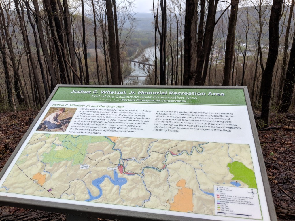
We originally purchased the land the trail is on (50 acres) when we acquired the Riverhouse. We had no plans to develop the land–we actually wanted it to remain wild. Through a series of fortunate events and hope and dreams, the Western Pennsylvania Conservancy purchased the land from to do just that–conserve it. It’s fantastic for us, of course, but also for the town of Confluence and the area. My family and I had been hiking there (locally known as Klondike Ridge) forever and it’s a really special place to us. It’s so amazing to be able to share it!

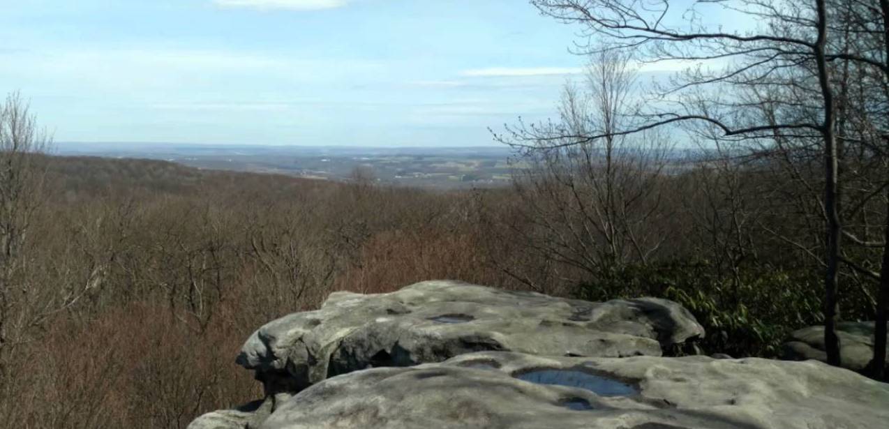
The trail is a bit steep but their are steps in the beginning and it does mellow out. It’s an out and back, well marked trail. Good hiking shoes recommended- especially when it’s wet.

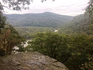
It’s short but takes you to a nice overlook of the confluence of the 3 rivers, or the “turkeyfoot”.

Go check it out and let me know what you think! ~Kara

Big Bear Lake

Strewn throughout Big Bear Lake Camplands,  Big Bear Lake Trail Center is quickly becoming known as the hot spot for classic east coast single track mountain biking. Years of trail development, by experienced mountain bikers, have created a trail system that will have you grinning ear to ear. The terrain has everything to offer; gradual climbs, large embedded rocks, tight slaloms, challenging rock gardens, and off the saddle downhills. Almost 50 miles of trail wind through knee deep ferns, soft needle pine plantations, and groves of mountain laurel. Riders of all ages and abilities will find trails to fit their individual riding skills and need for adrenaline.
Trail maps are provided at the main entrance. Trail fee is $10/day or $30 for a season pass. Season passes can be purchased at the main entrance or online HERE.


All trails may be used for hiking, trail running and x-c skiing. Trails are closed from November 1 to December 31.

Ferncliff Peninsula

Ferncliff Natural Area is a 100- acre peninsula in the 20,000 acre plus Ohiopyle State Park. Hemlock, tulip poplar, oak, and black birch are some the tree species, with the oldest about 200 years. The peninsula is created by a meander in the Youghiogheny River which flows north into Pennsylvania from West Virginia and Maryland carrying seeds from that region. The warmer microclimate inside the river gorge allows these plants to survive. It is a good example of a late successional forest in the Allegheny Mountains, and forever protected. Views of the river and the falls can be seen from the relatively easy trail. This is a very popular ecotourism area.

Continue reading…

Ohiopyle State Park

Located on the southern reaches of the Laurel Ridge, Ohiopyle State Park encompasses approximately 20,500 acres of rugged natural beauty and serves as the gateway to the Laurel Highlands. Close to major metropolitan areas and offering vast choices of activities, Ohiopyle State Park attracts millions of visitors annually. Confluence is 5 miles from the park. It’s a 15 minute drive to the Falls.

Passing through the heart of the park, the rushing waters of the Youghiogheny [yawki-gay-nee] River Gorge are the centerpiece for Ohiopyle. The “Yough” [yawk] provides some of the best whitewater boating in the eastern United States, as well as spectacular scenery.

Ohiopyle is the southern gateway into the Laurel Highlands and represents the beautiful natural resources and unique sense of community that visitors can find throughout the region.

More information here

Laurel Highlands Hiking Trail

The Laurel Highlands Hiking trail is a 70-mile backpacking and hiking trail in Western PA. Part of the Potomac Heritage Trail, it is one of the most celebrated Pennsylvania hiking trails for its varied terrain and wondrous beauty.

The Laurel Highlands Hiking Trail runs from Ohiopyle State Park to the Laurel Ridge State Park meeting the 1,000-foot Conemaugh Gorge near Johnstown. It traverses state parks, forests, game lands, preserves and other public and private lands.

On the Laurel Highlands Hiking Trail, you’ll pass eight overnight areas approximately every 8 to 10 miles. All are equipped with fresh water, Adirondack-style shelters, tent pads and comfort stations. Whether or not you stop along the hiking trail is up to you. But, you’ll never be far from a place to rest, relax, or call it a day.

The Ohiopyle State Park and the Laurel Highlands Hiking Trail are open year-round, and visited by over one million people every year. But with almost 20,500 acres of natural beauty and scenic vistas throughout the park, you’ll find it as peaceful as it is beautiful. The Laurel Highlands Hiking Trail is blazed approximately every 100 feet with 2-inch and 5-inch yellow blazes. Connector trails lead to and from parking and shelter areas and are marked with blue blazes. Mileage monuments are every mile. Pets are permitted.

More information can be found here

Geocaching

Looking for something to do outdoors but having a hard time motivating the kids? Want to venture off the beaten path but don’t know where to go? Geocaching is a fun way to explore the area. It’s perfect for kids–and grown ups alike.

What is geocaching? In short, it’s a real life treasure hunt. You need an app and a sense of adventure. Caches range from easy to difficult to get to and find, from big to tiny. Go to www.geocaching.com and check it out.

Download the app to your phone. The free app is OK, but for $5.99 a month (you can sign up for 1 month) or $29.99 for a year you can see all of the best caches. Just pick a couple of caches and follow the coordinates and clues (if you want).

Grab some small toys or trinkets from under your car seat or run to the Dollar General and grab some. (We like to leave extras in a cache that hasn’t been restocked recently). *our kids say that dollar bills, matchbox cars and pocket knifes are highly recommended.

When/if you find a cache, you can take a trinket and leave one. Don’t forget to sign the log book and cover it back up like you found it.

Don’t get frustrated if you feel like you are turning in circles when you are close. You can always check the hints. Be patient and you’ll find it.

One of my favorite things about geocaching is that you’ll discover all kinds of unknown spots in the area…like bare rock overlooks and old cemeteries full of interesting history.

Here’s a helpful article about geocaching.

The Confluence zip code is 15424.
Here are some of our favorite caches:
GC1DCNZ, GCXF2K, GCNGGQ

Great Allegheny Passage (GAP) Rail Trail

You can ride and hike the former rail road bed called the Great Allegheny Passage (GAP) bike trail all the way from Pittsburgh to Washington, DC and make Yough Tree or Riverhouse a retreat from all the pedaling.

If the entire 200+ journey isn’t on your agenda, shorter day trips from our homes are a great way to get some exercise and see the area. The trail is shady and follows the river, so even on a hot day it’s pleasant. Turn left at the end of our road (cross Yough River Bridge) and follow the Yough River downstream to Ohiopyle (11 miles) or turn right and follow the Casselman River to the town of Rockwood ( 18 miles). There is a well stocked bike shop in Confluence, Confluence Cyclery as well as shops in Ohiopyle and Rockwood. Looking for a bike tour, check out local company, Wilderness Voyageurs. For more information about the trail visit here.